 E-mail alert
 Rss
Rss
当期目录
2026年 第14卷 第2期
显示方式:
2026,
14(2):
123-147. doi: 10.26599/JGSE.2026.9280075
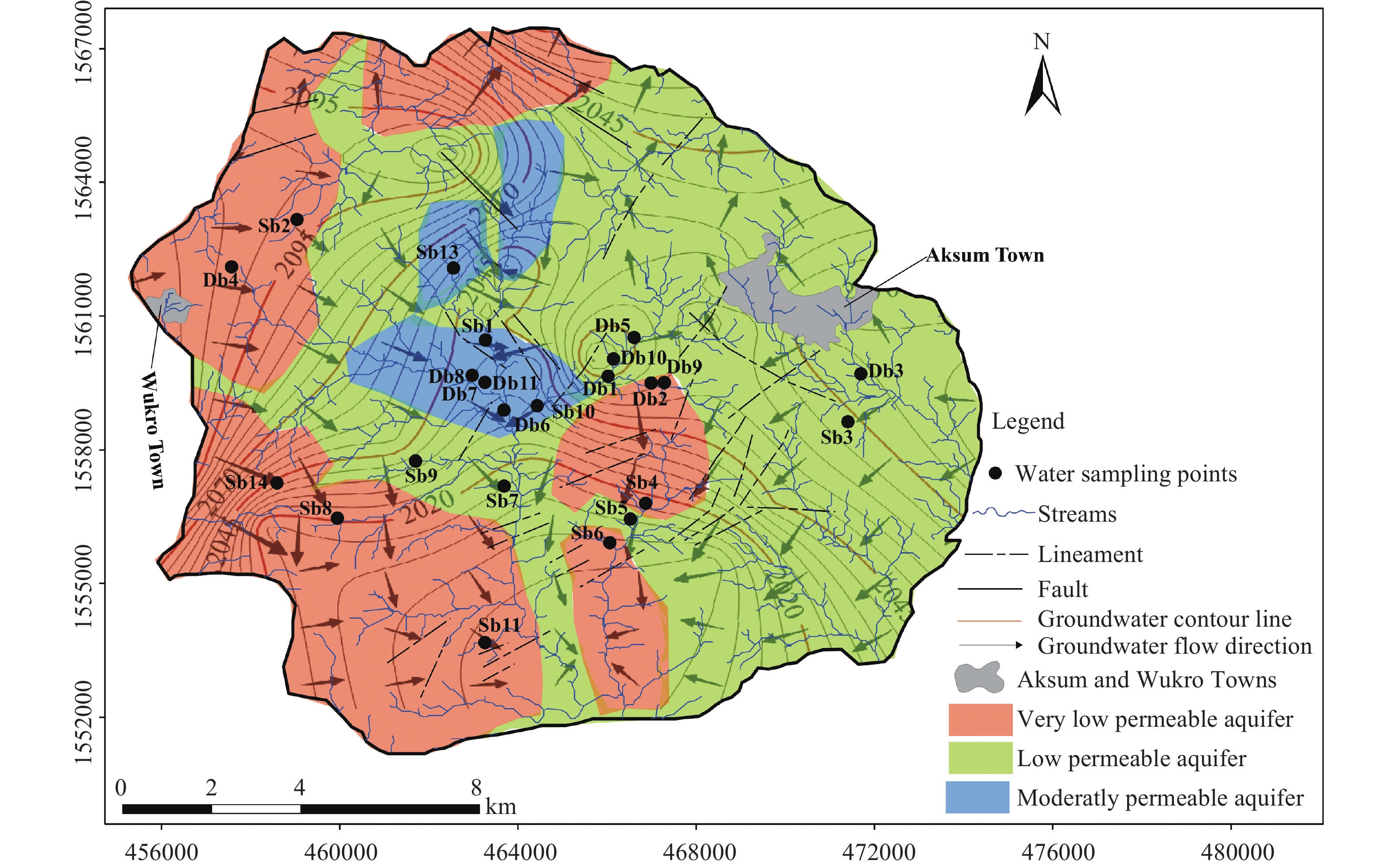
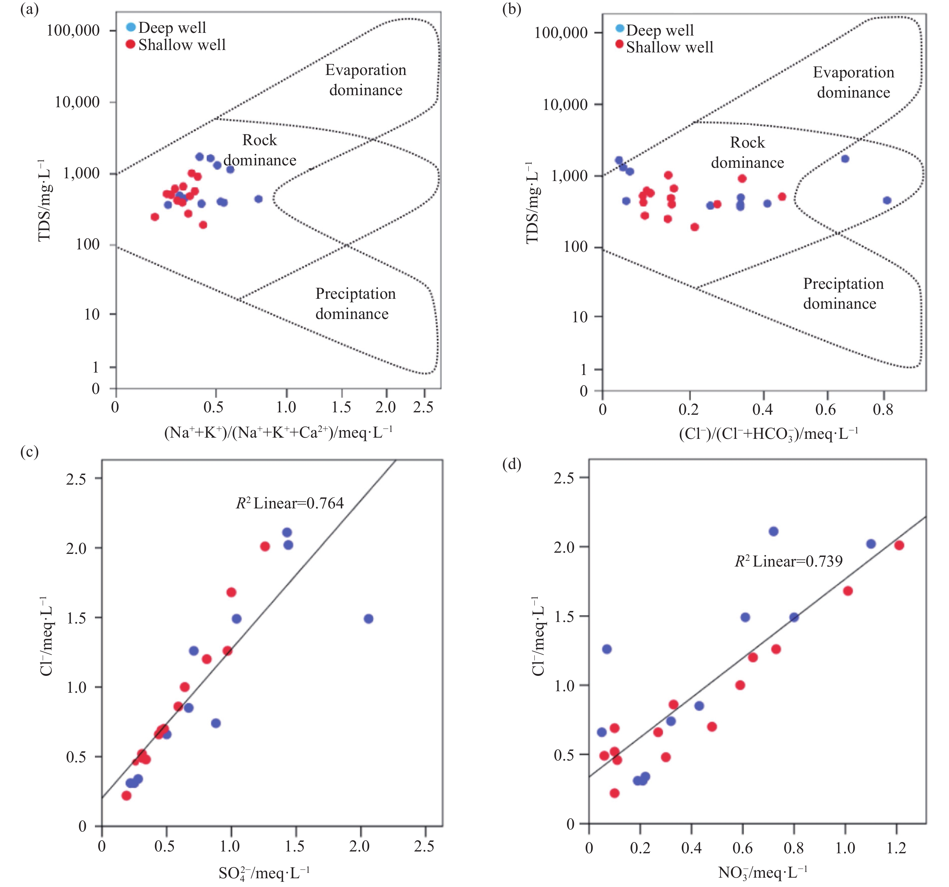
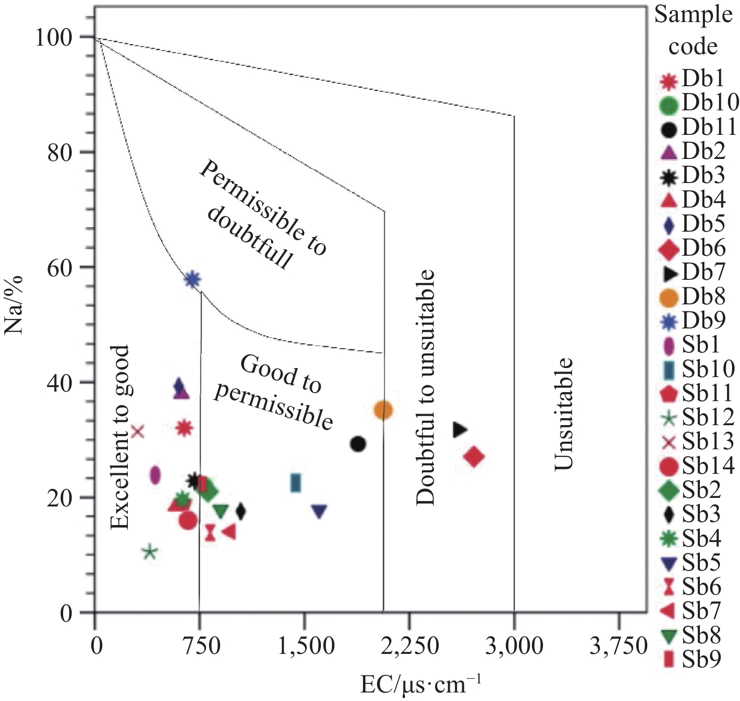
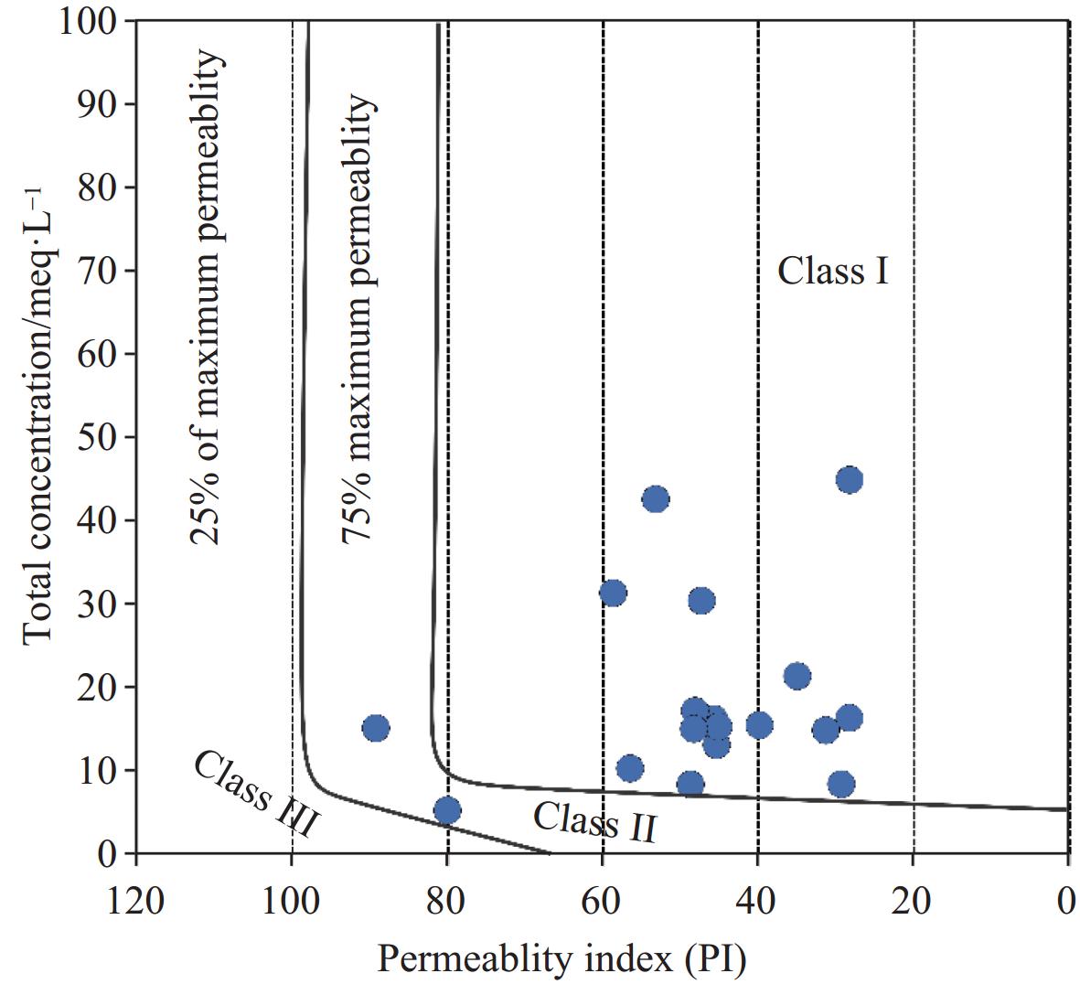
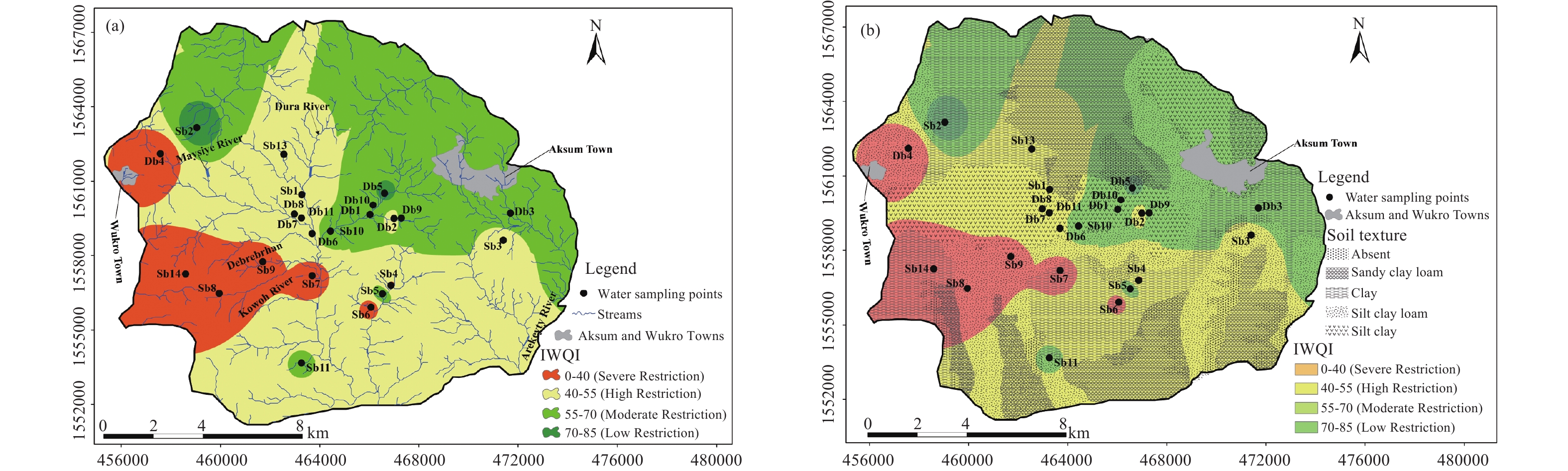
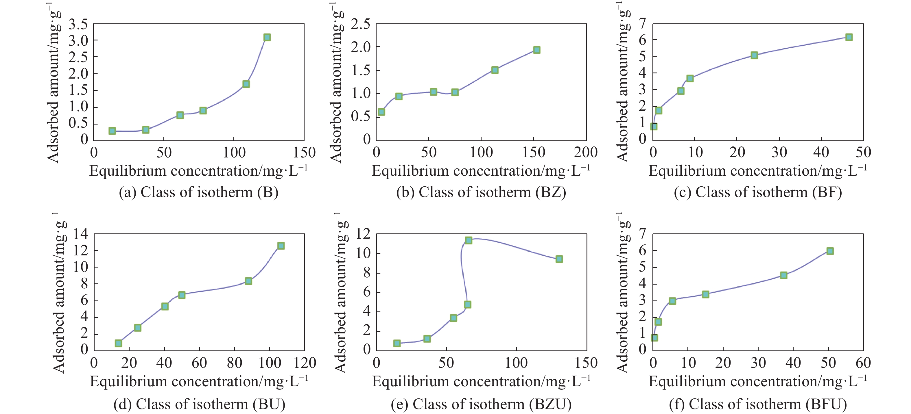
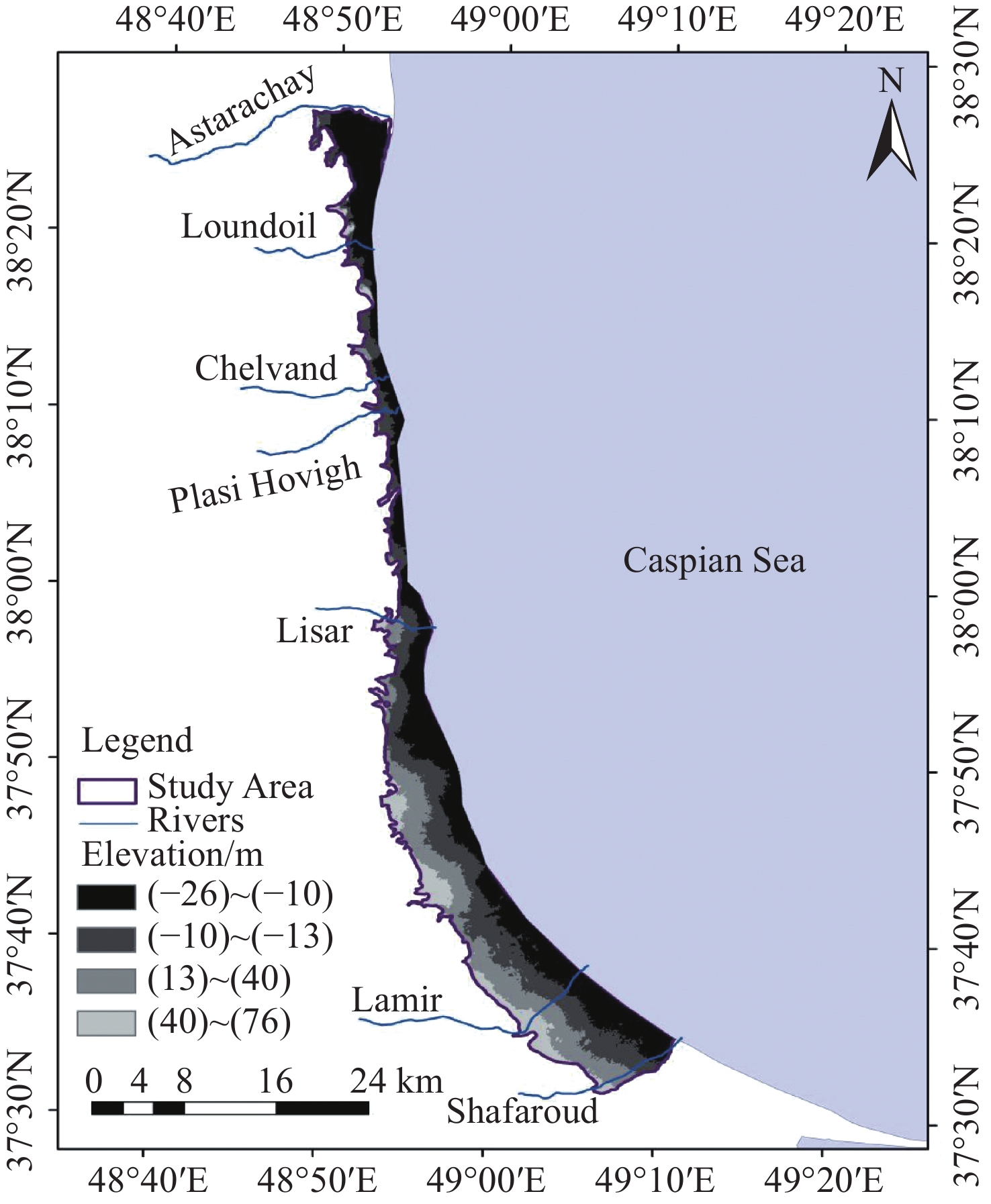
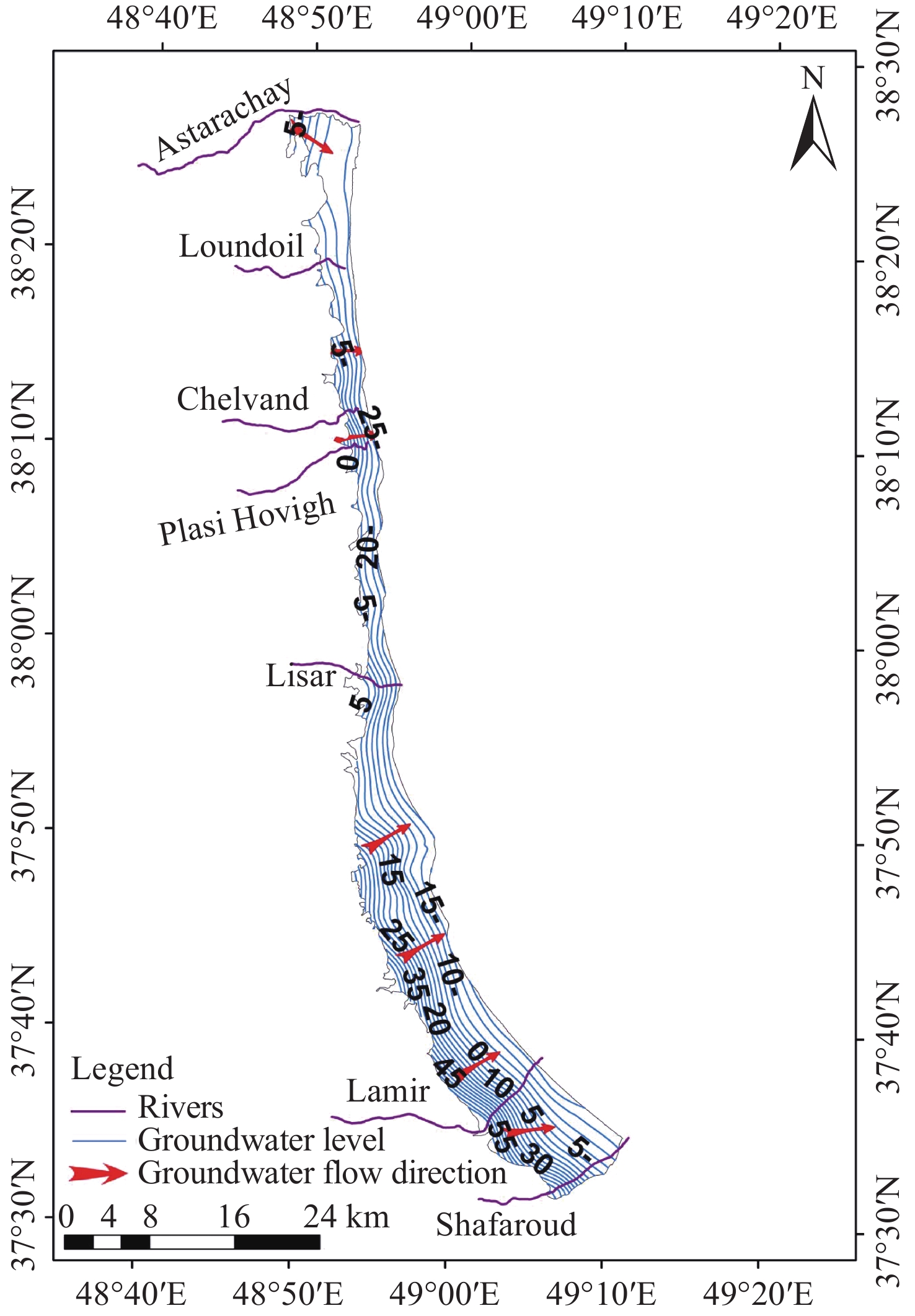
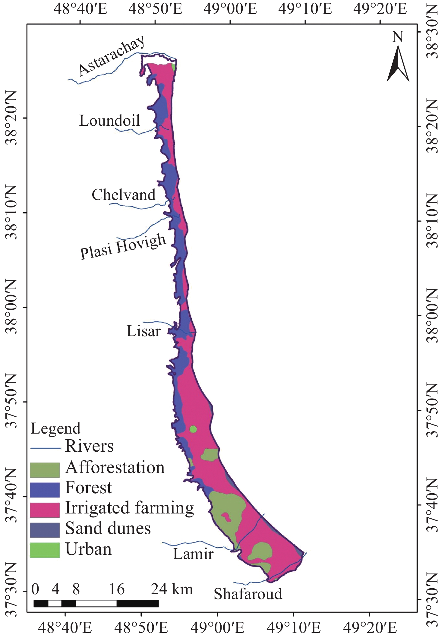
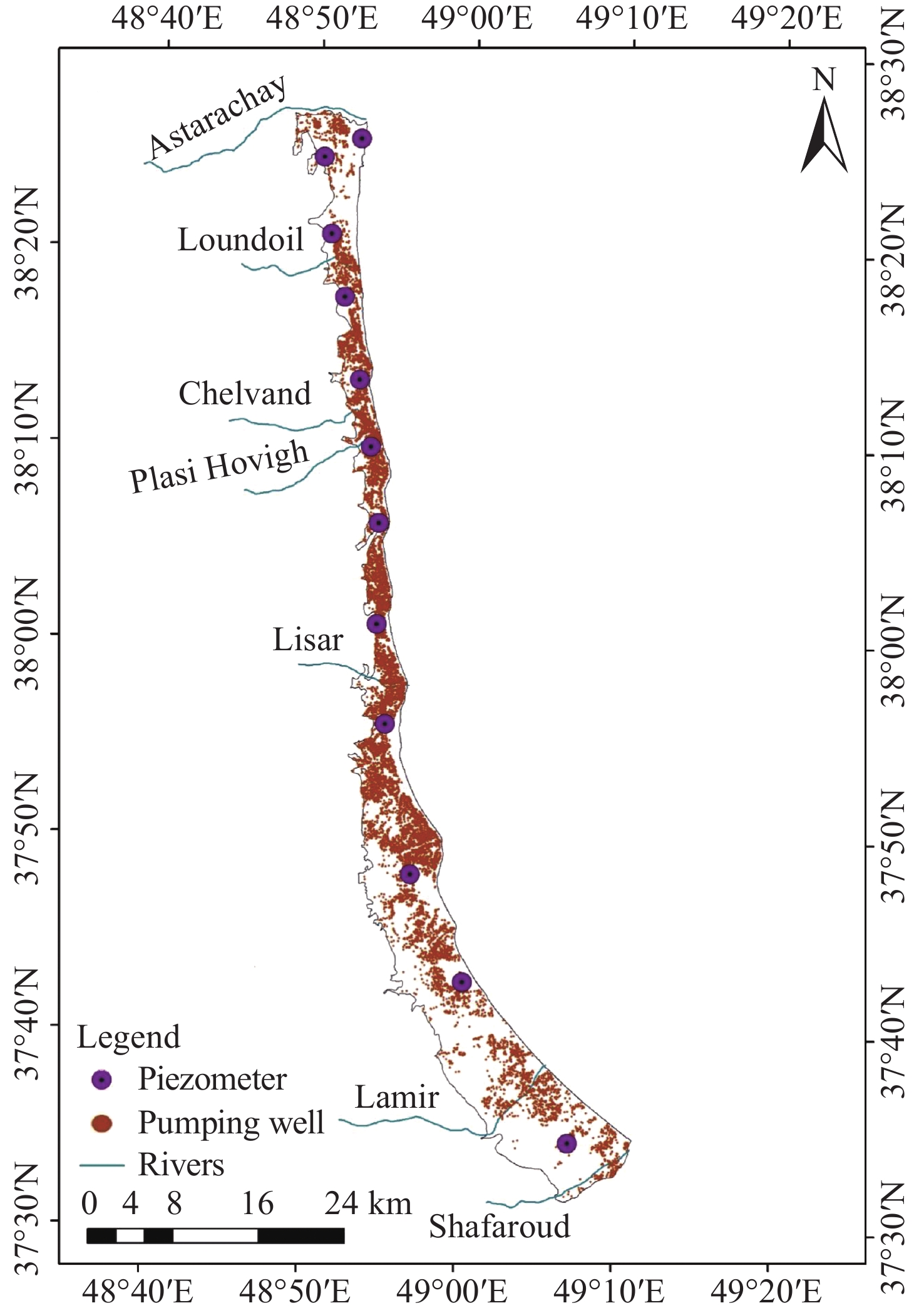
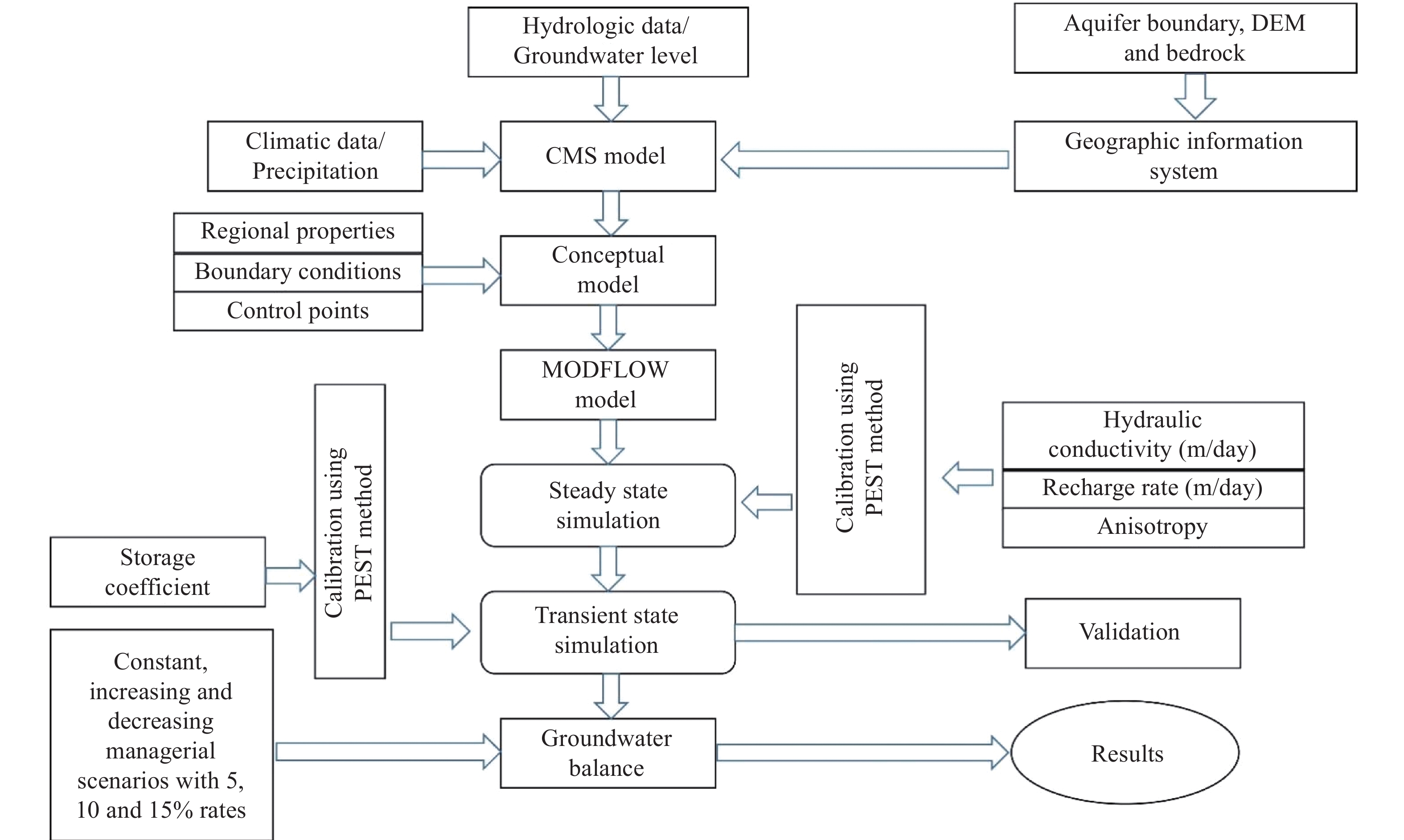
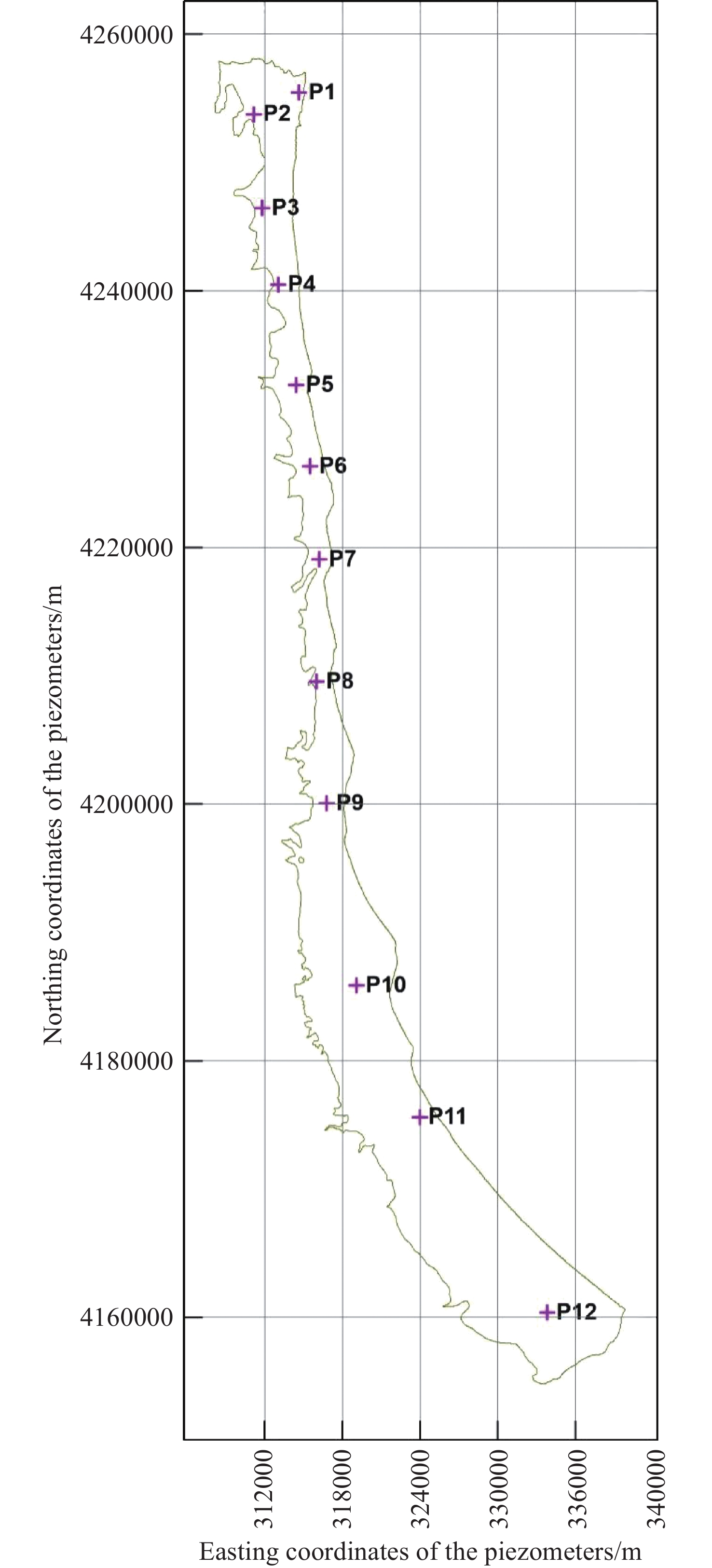
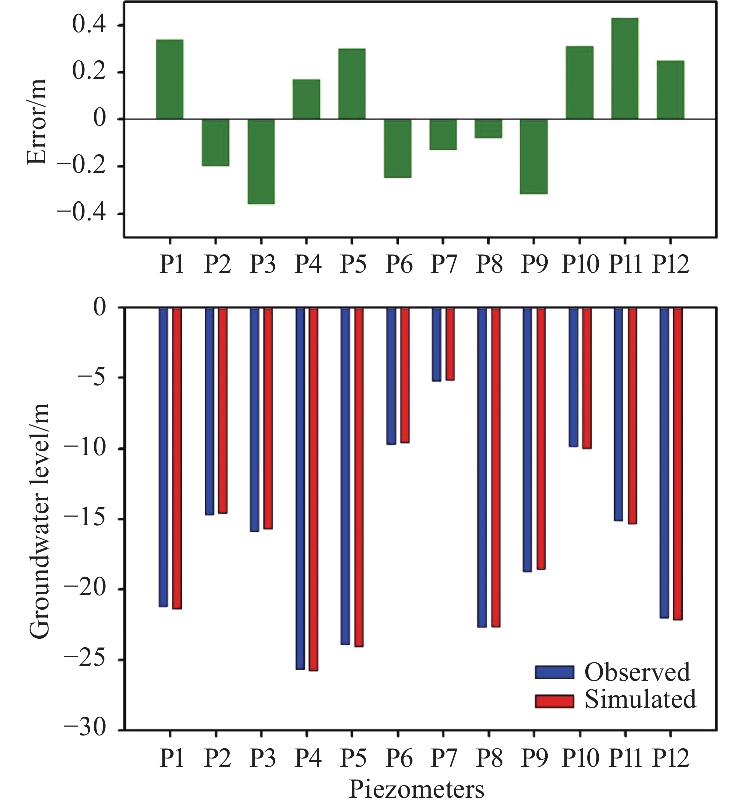
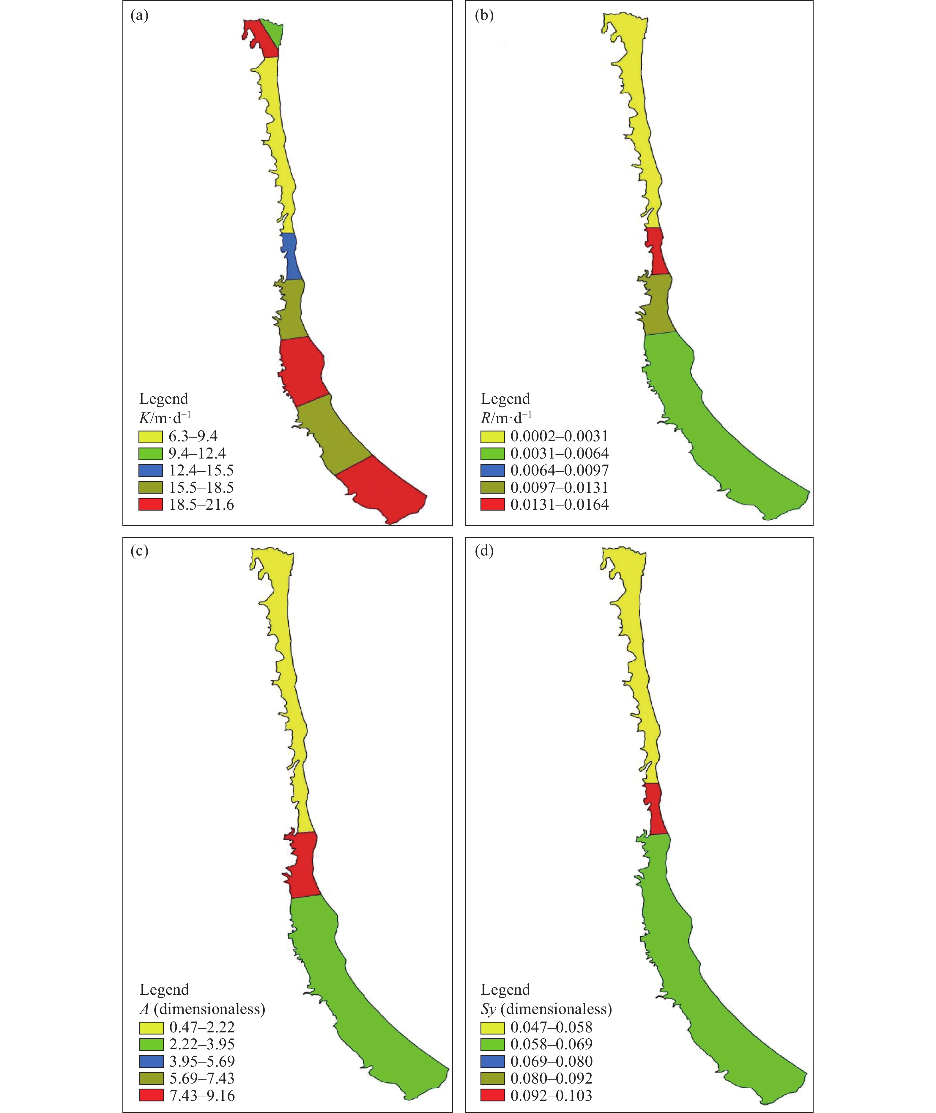
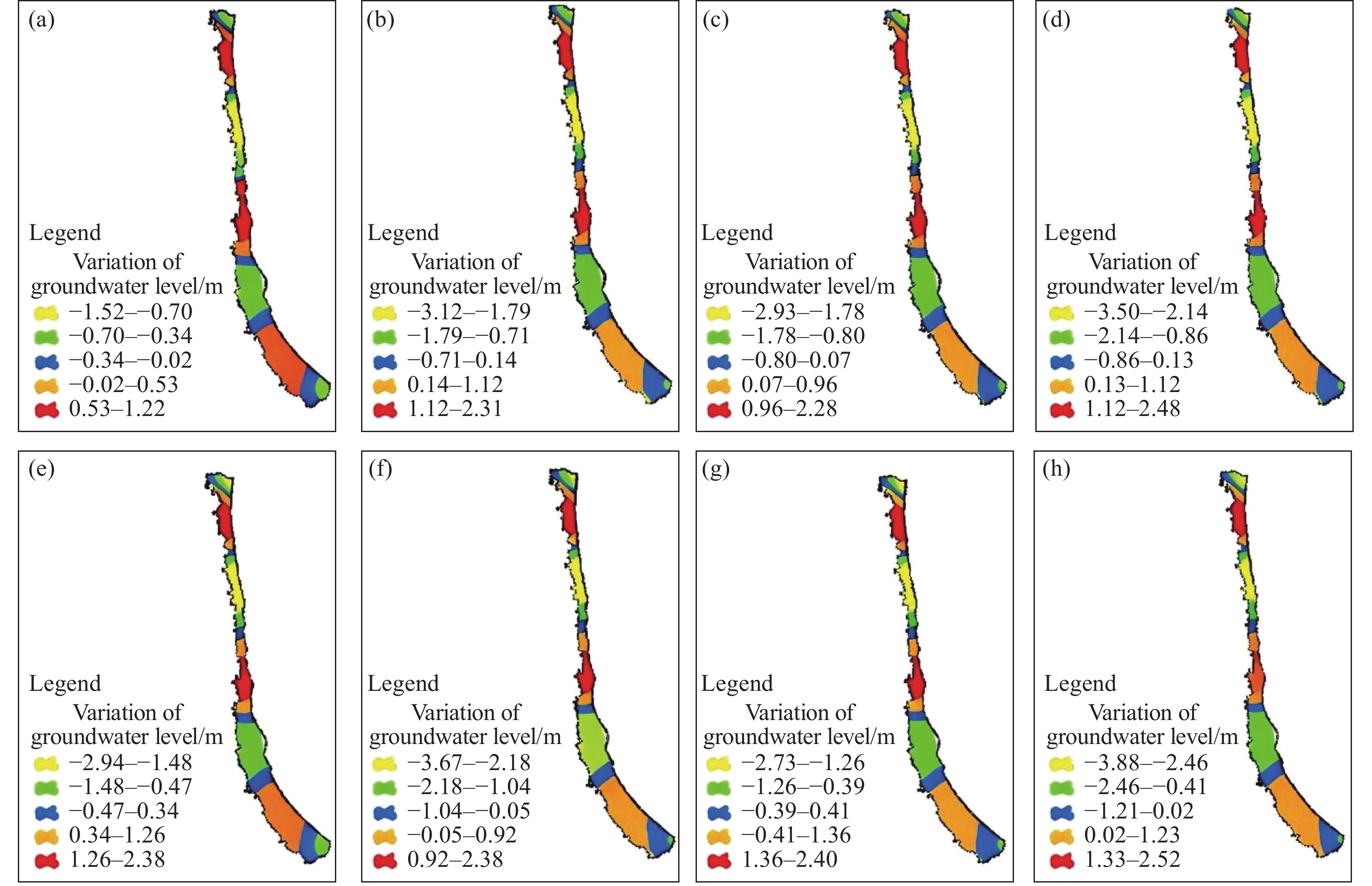
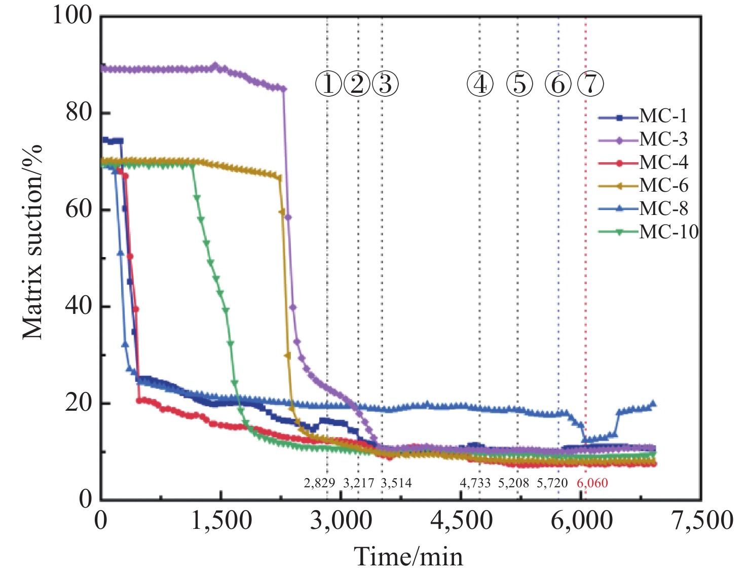
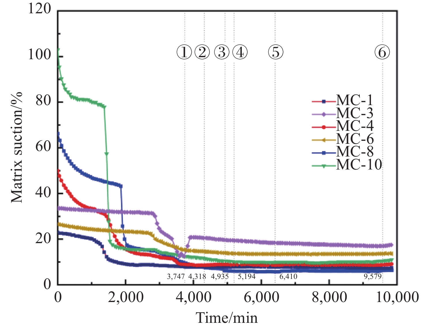
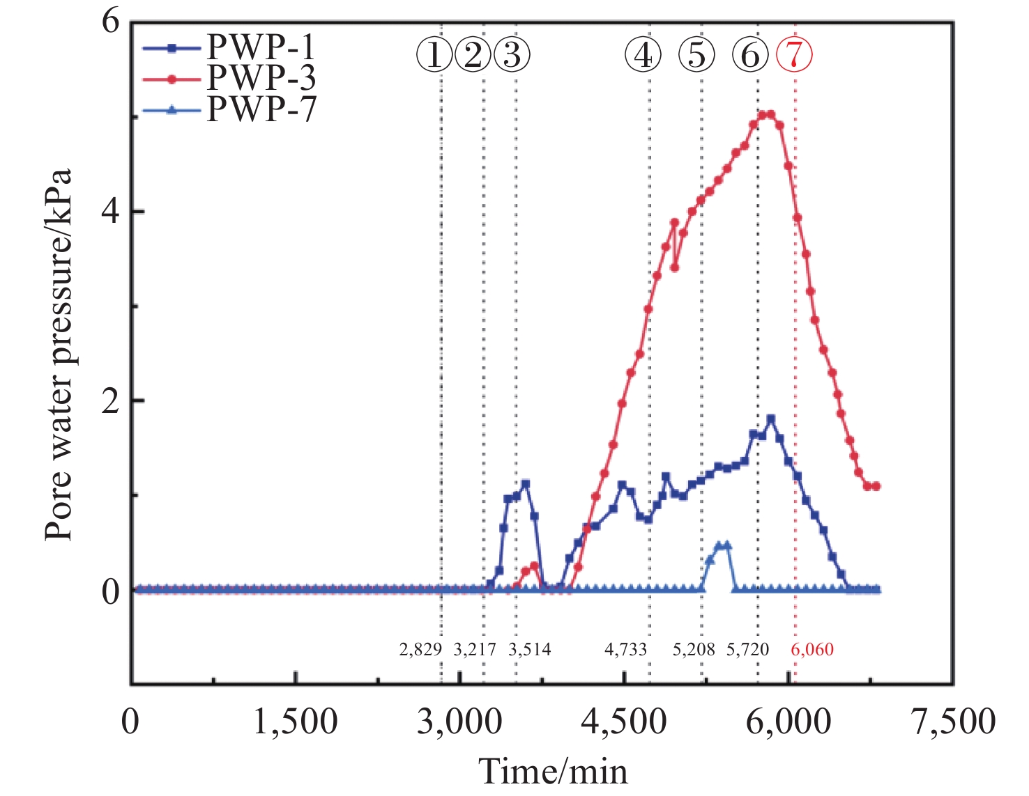
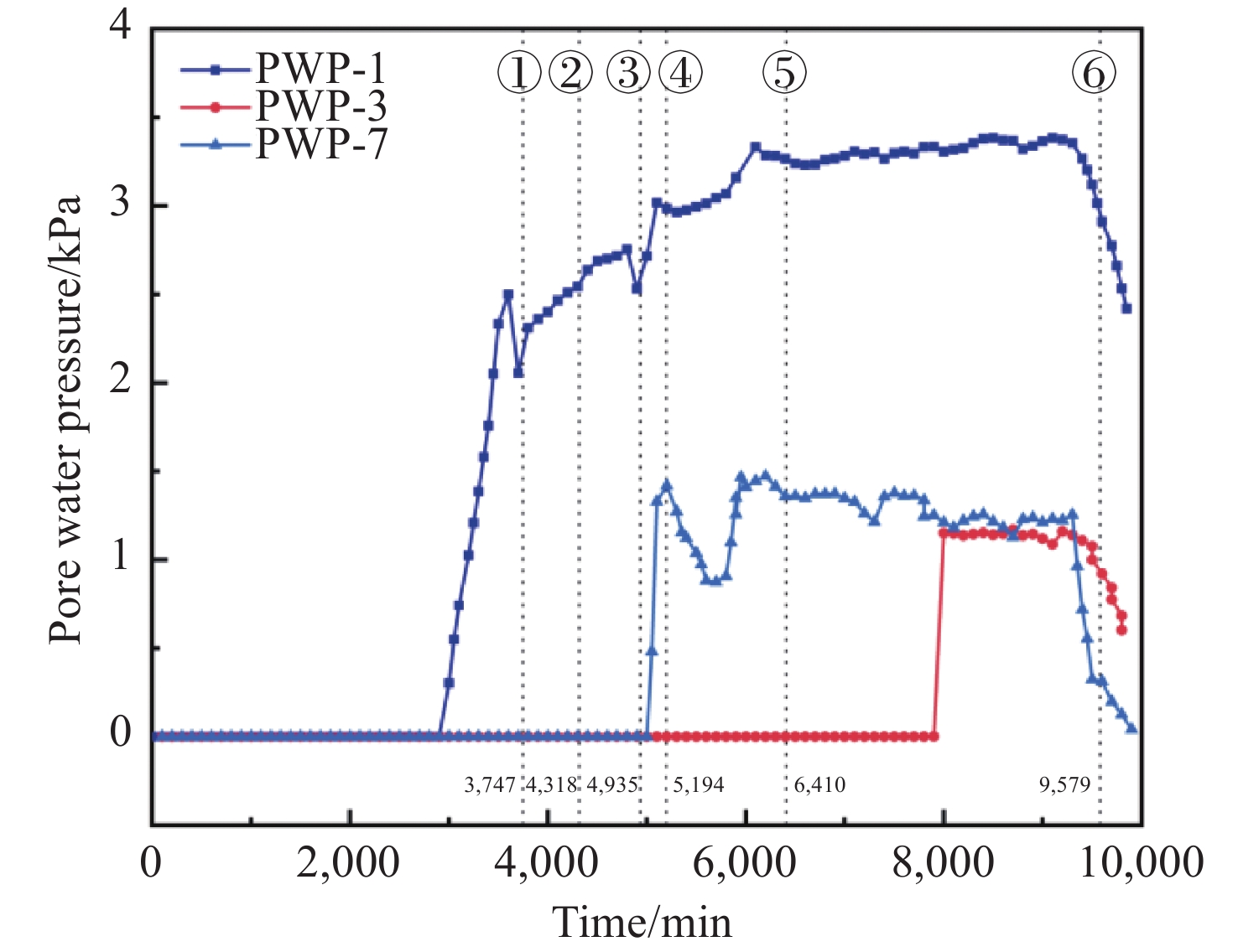
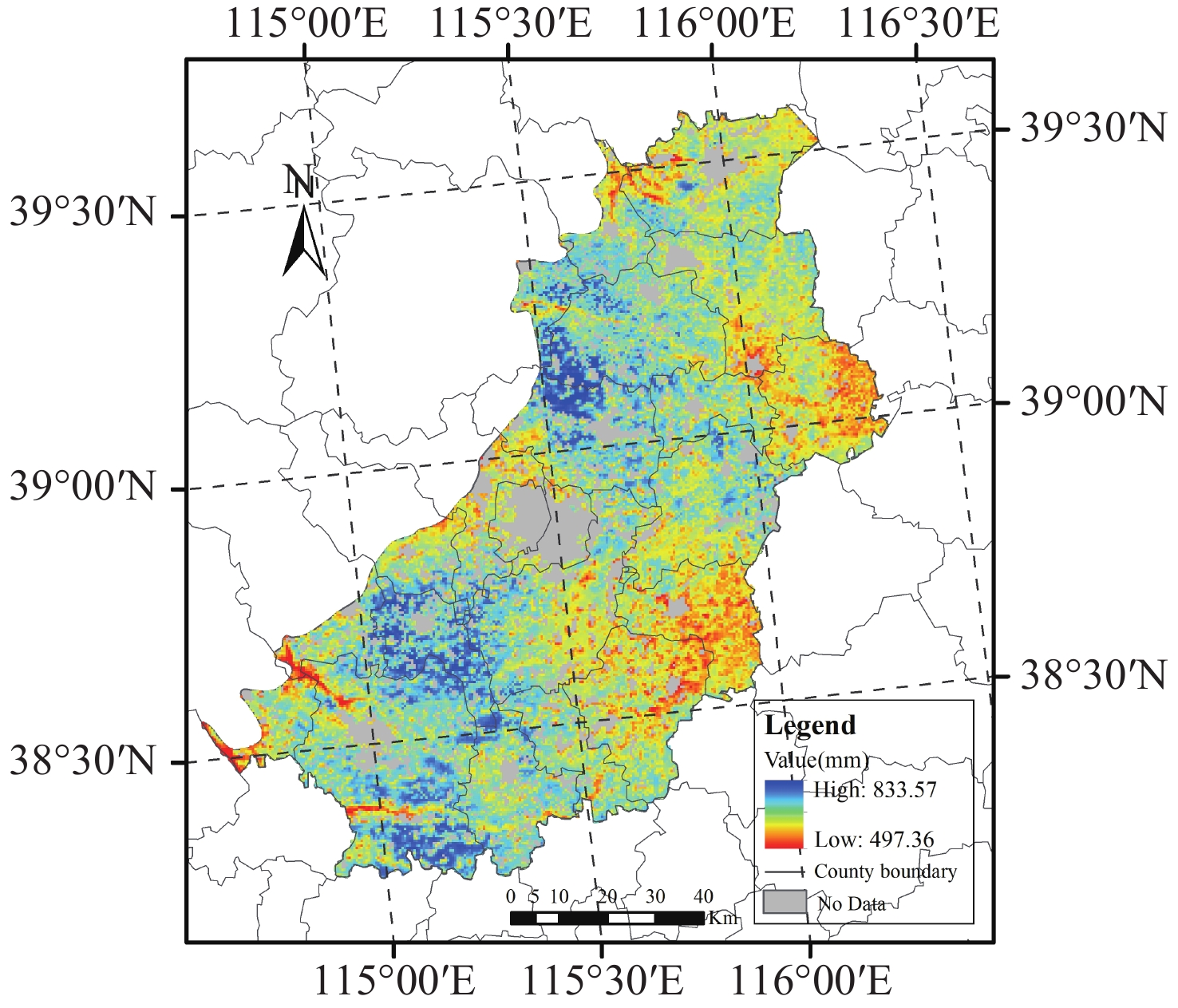
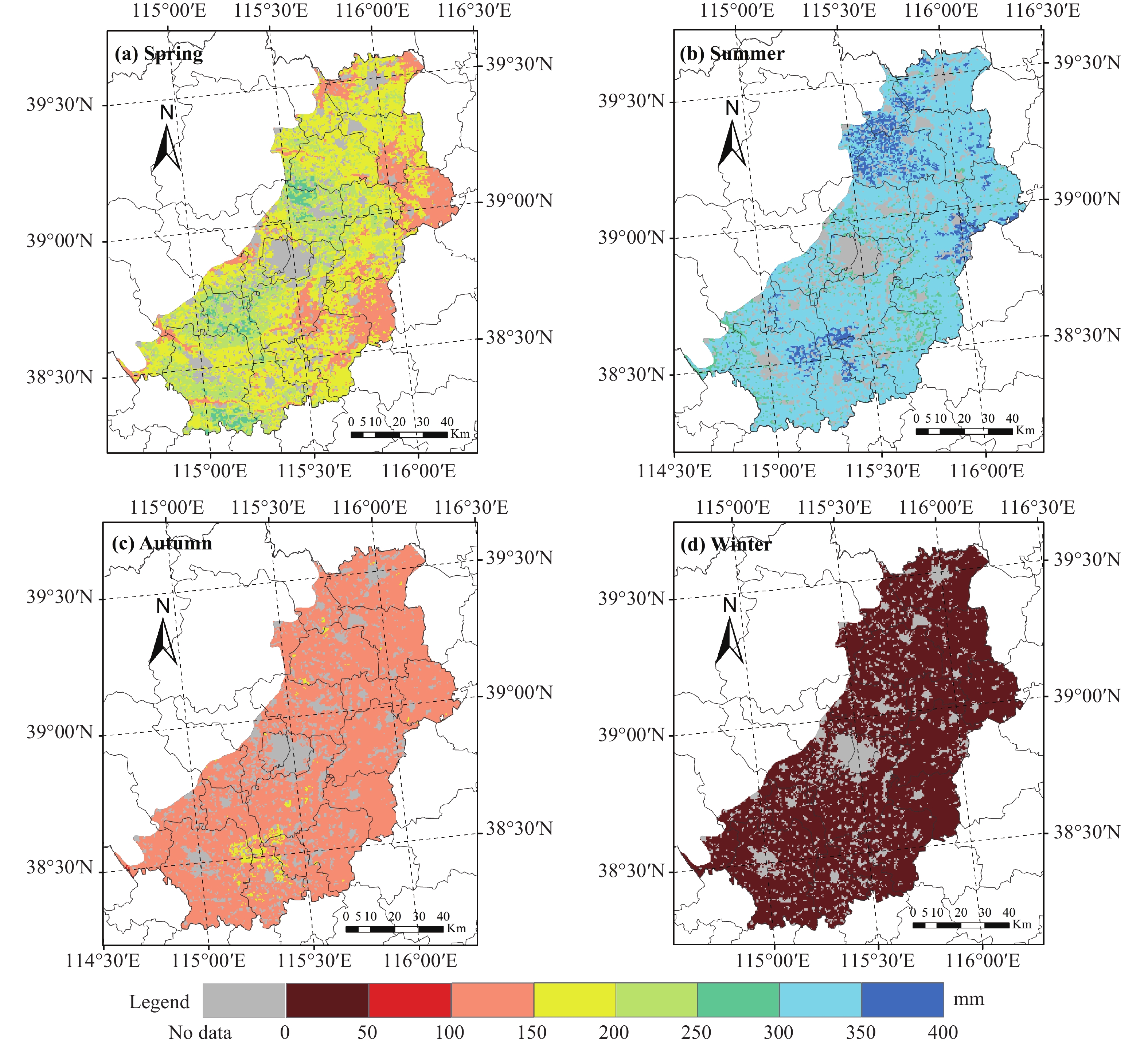
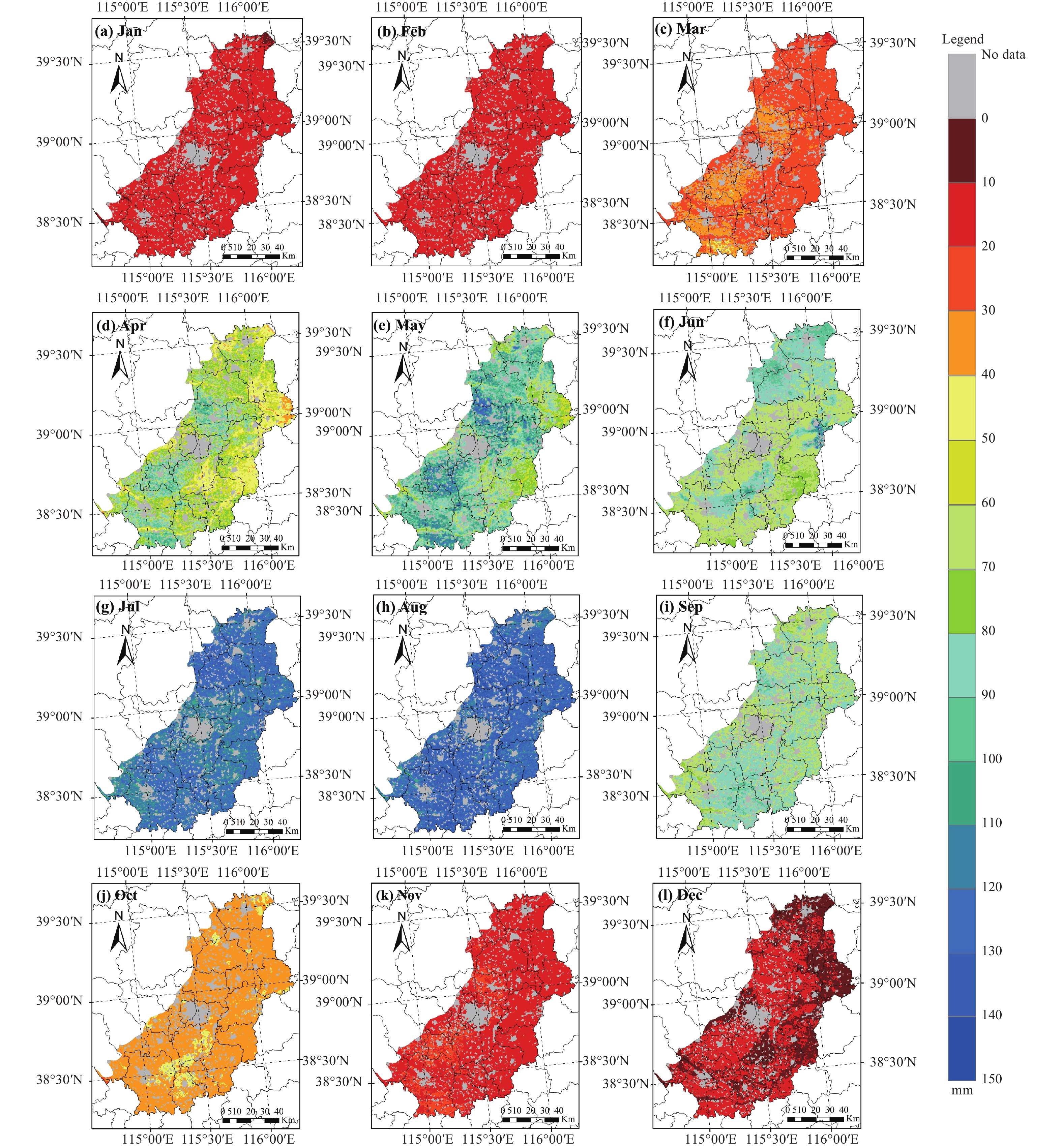
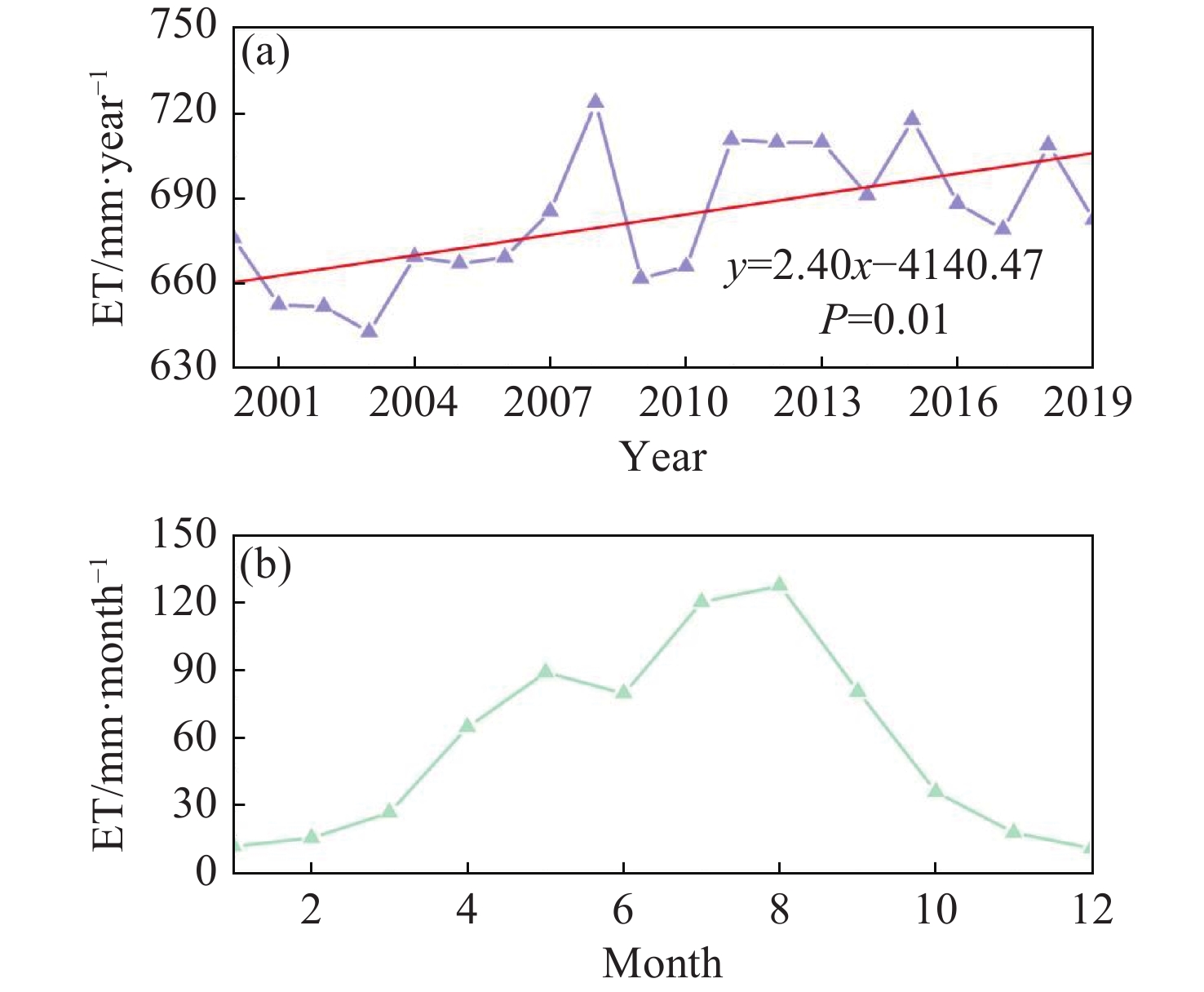
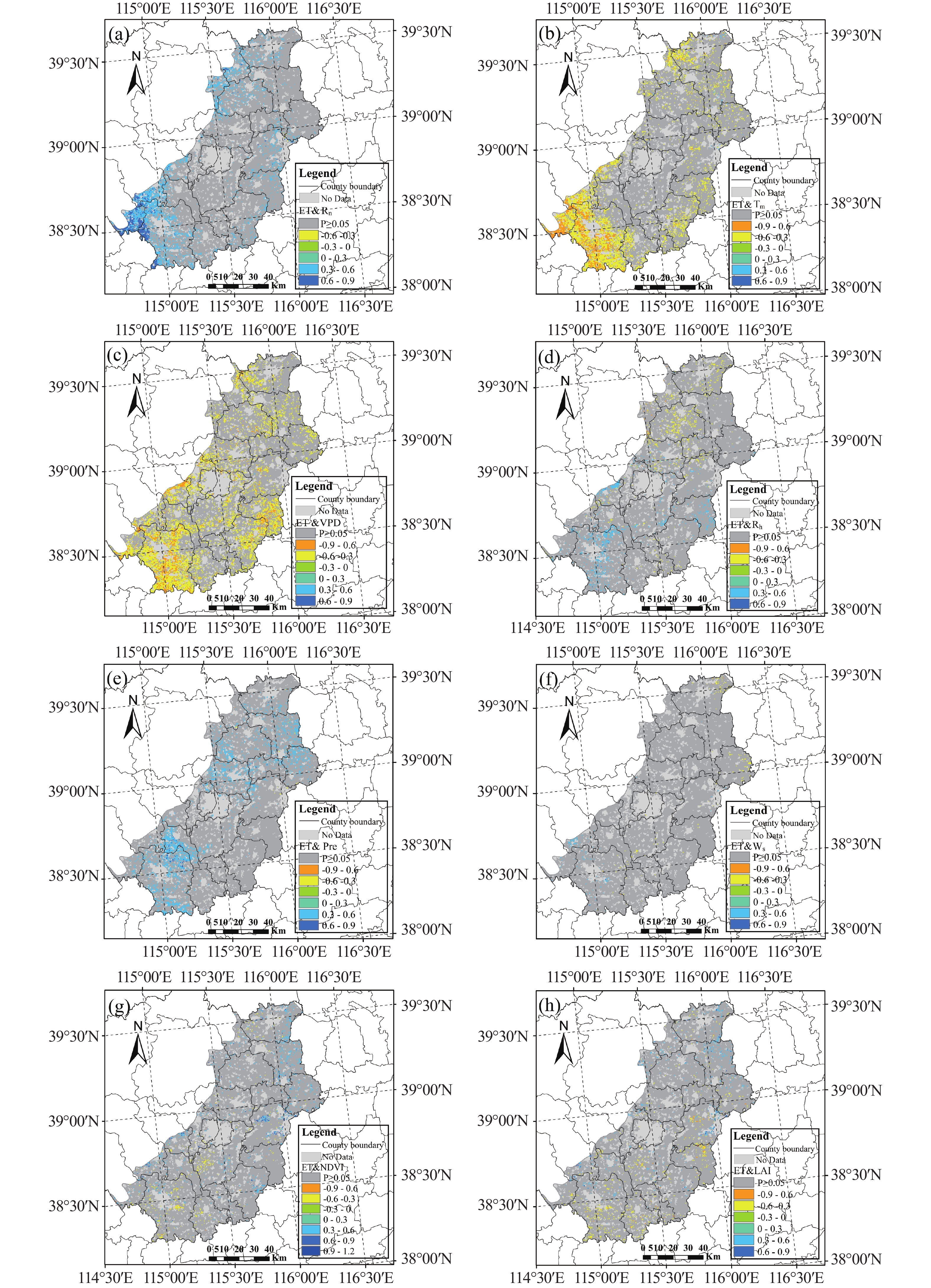
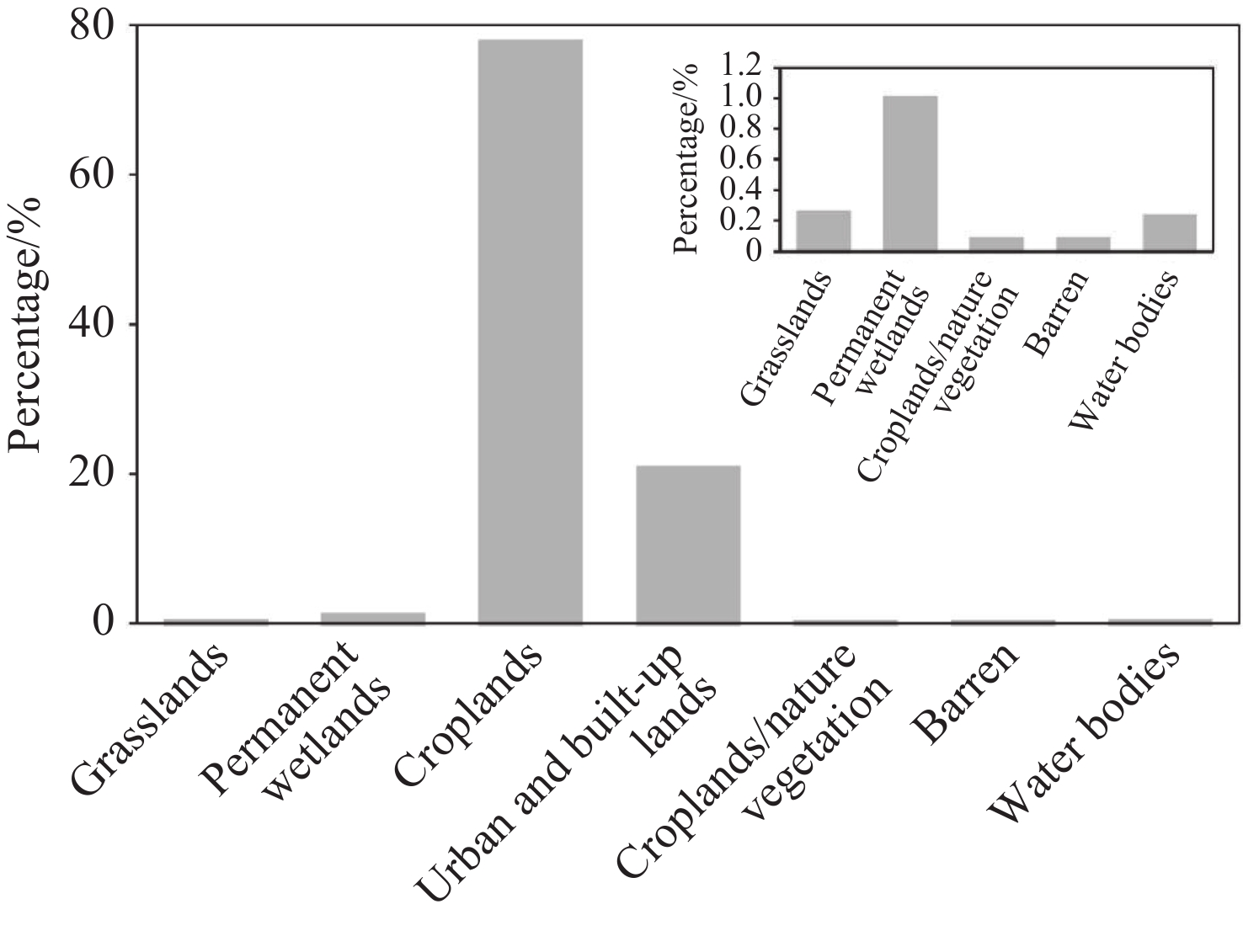
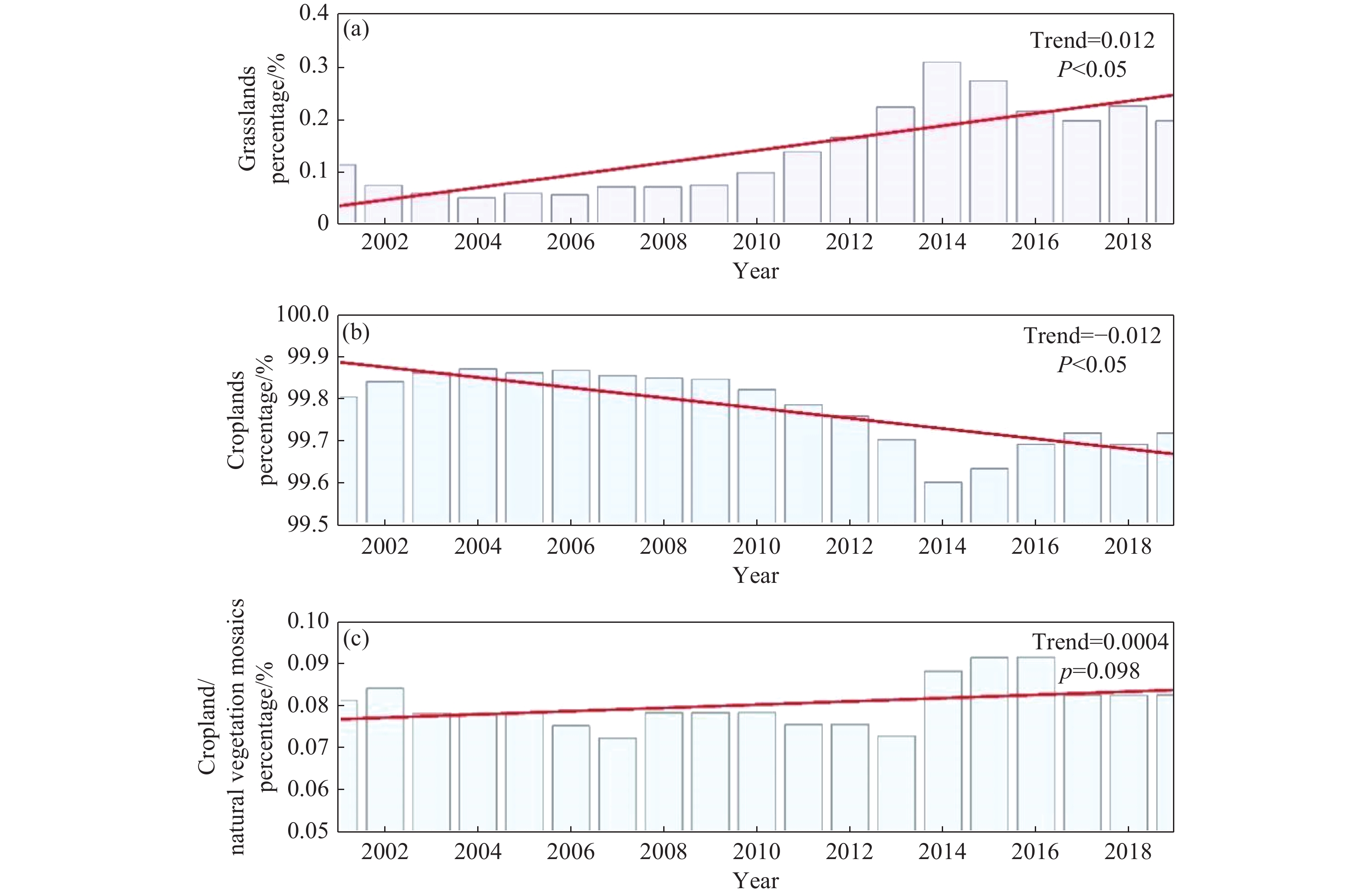
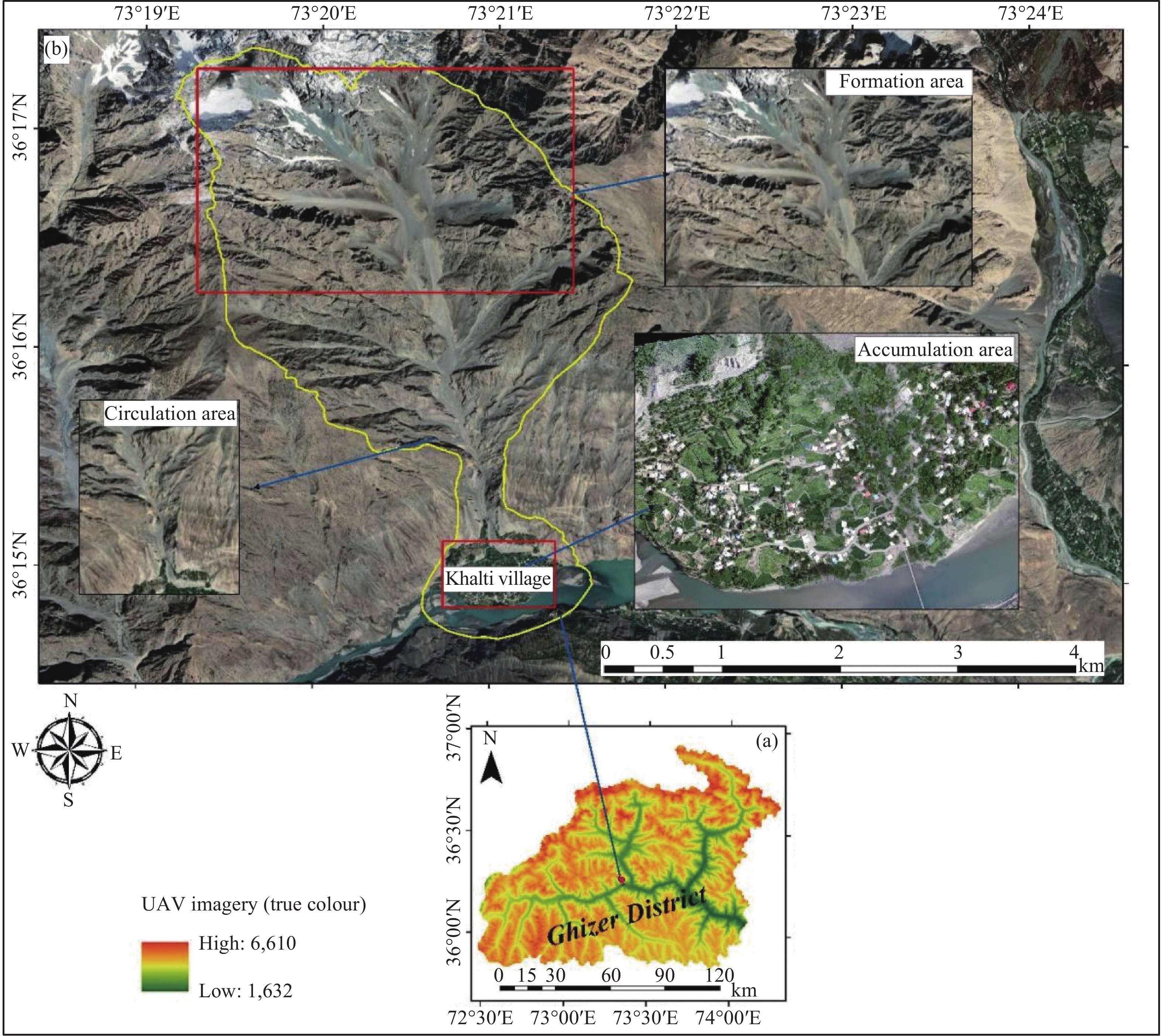
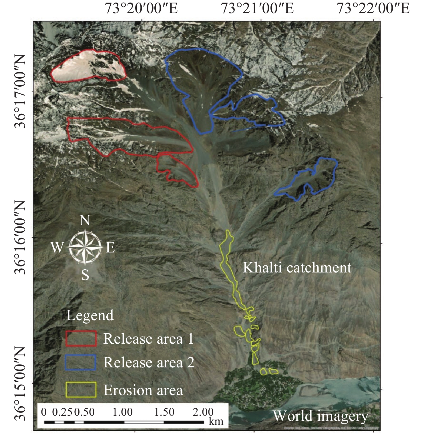
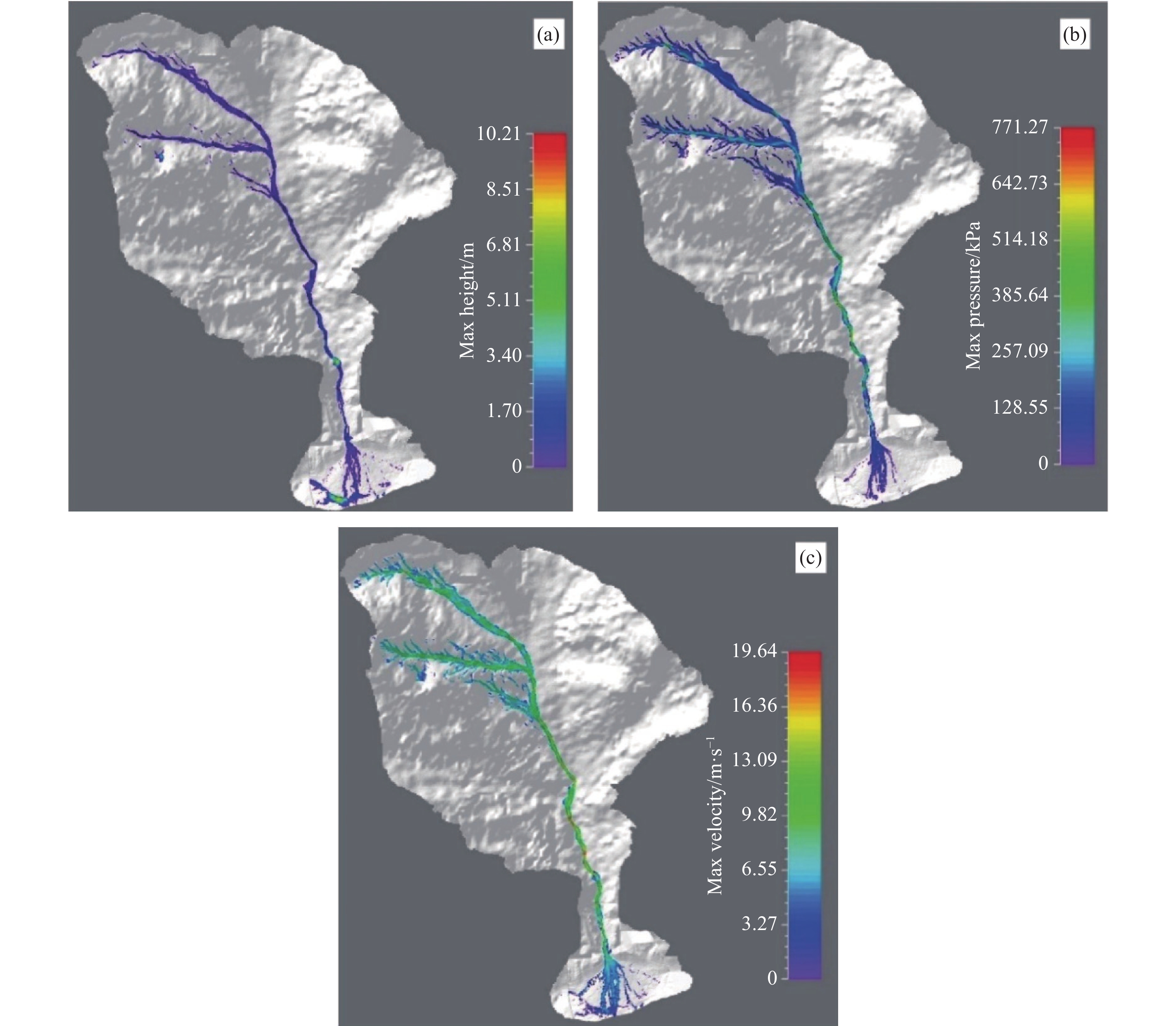
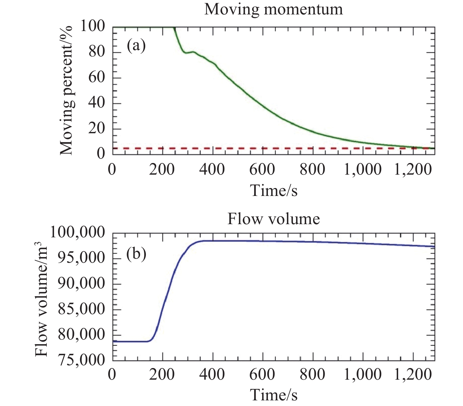
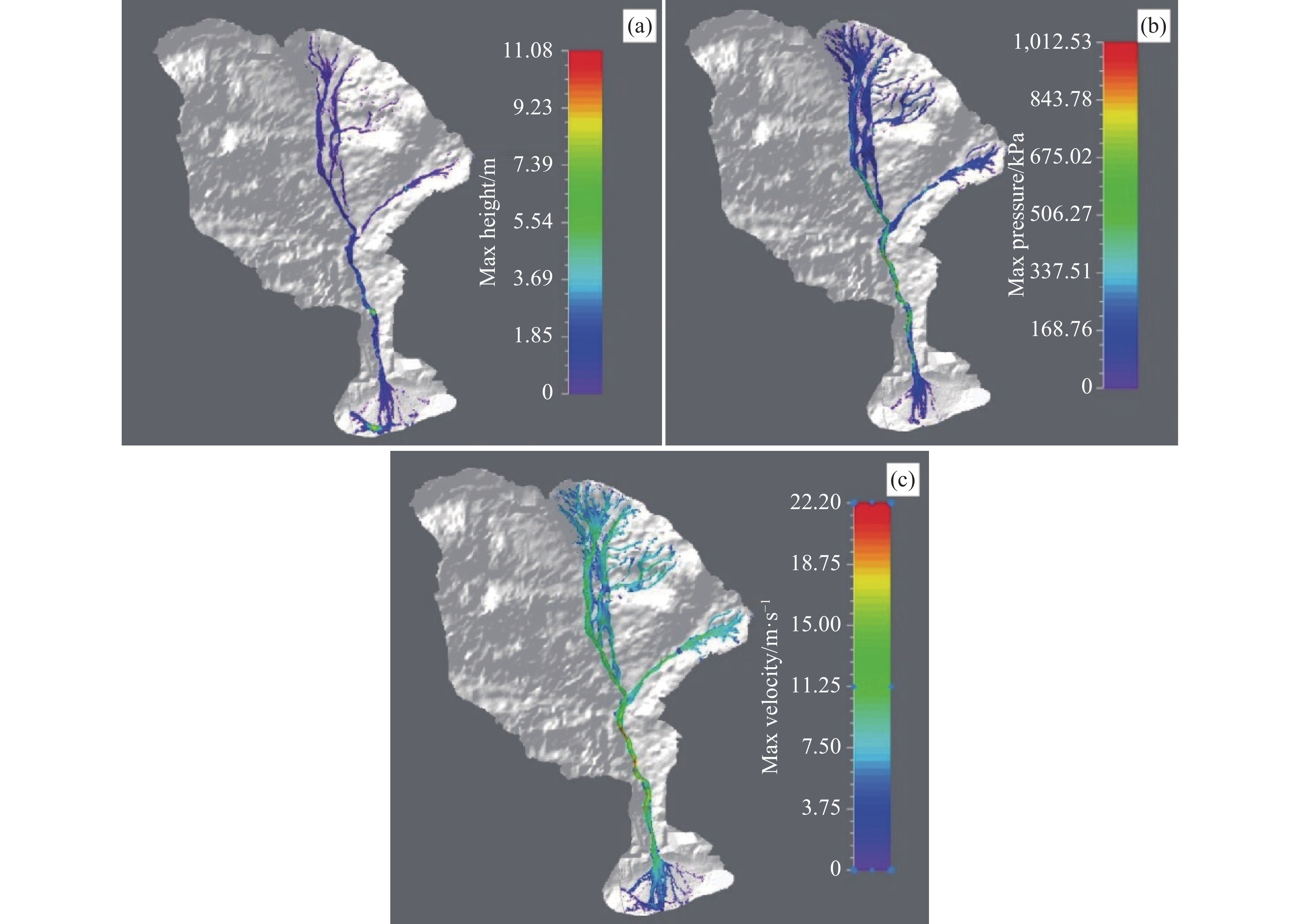
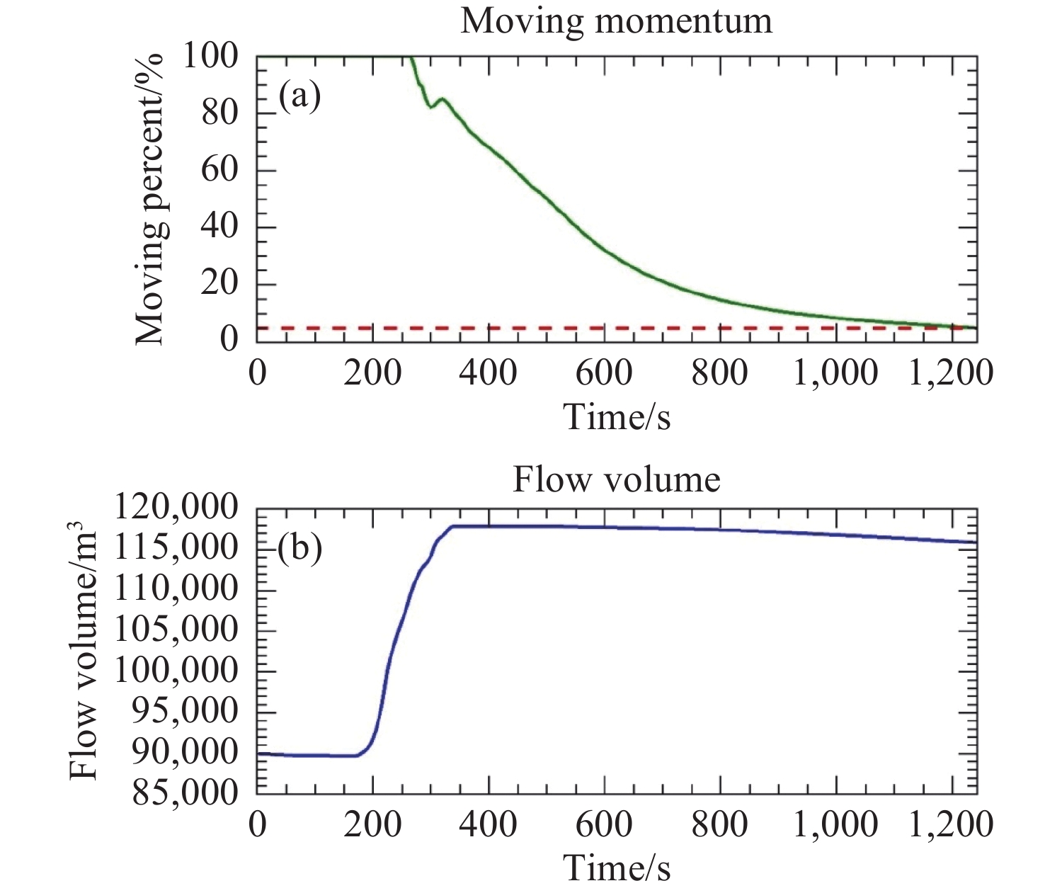
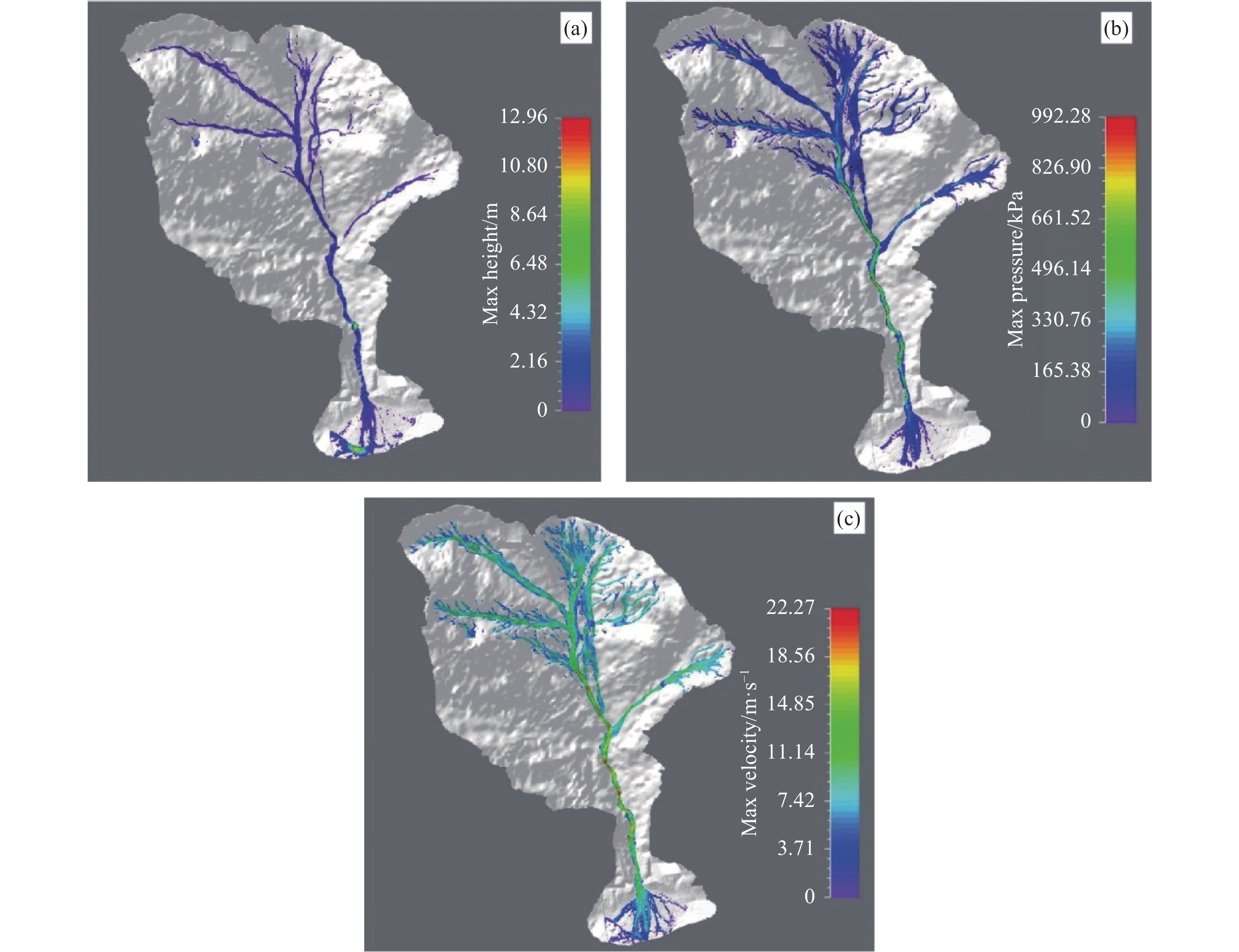
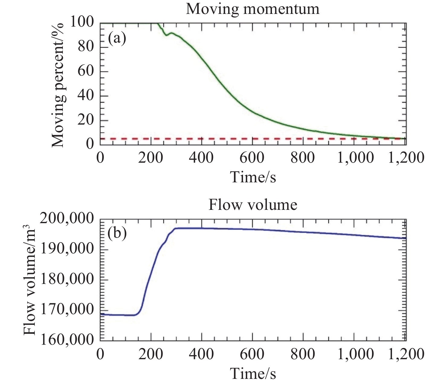
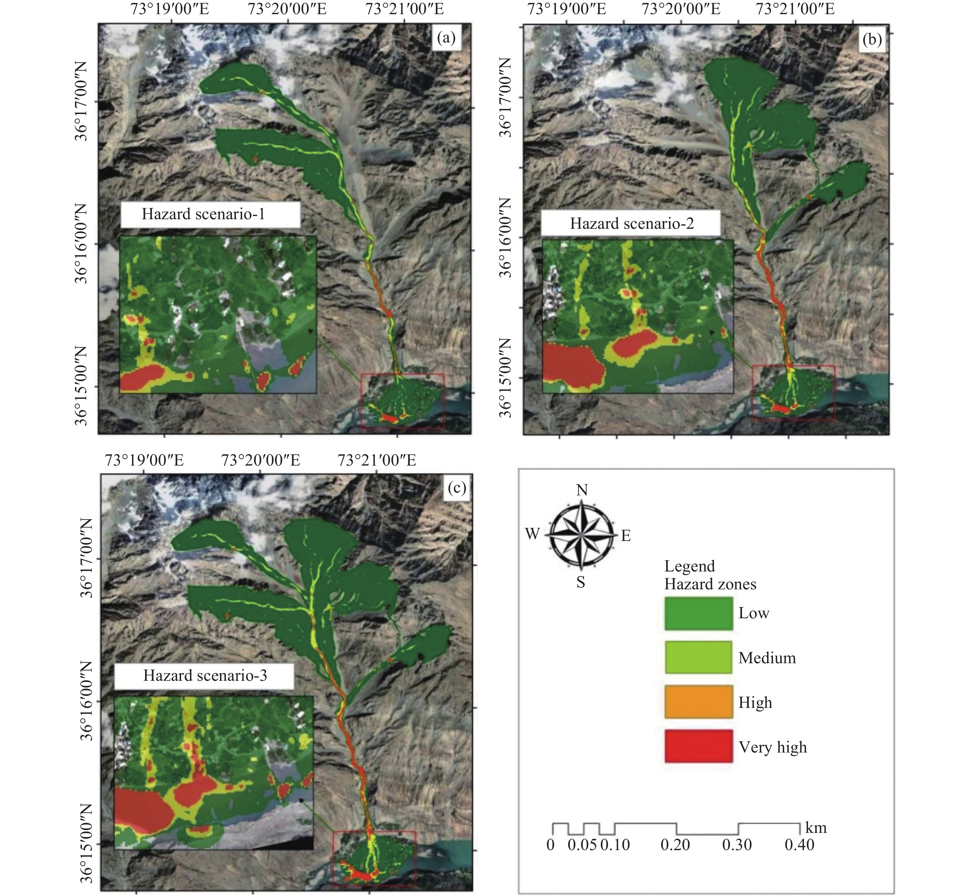
摘要:


2026,
14(2):
165-187. doi: 10.26599/JGSE.2026.9280077
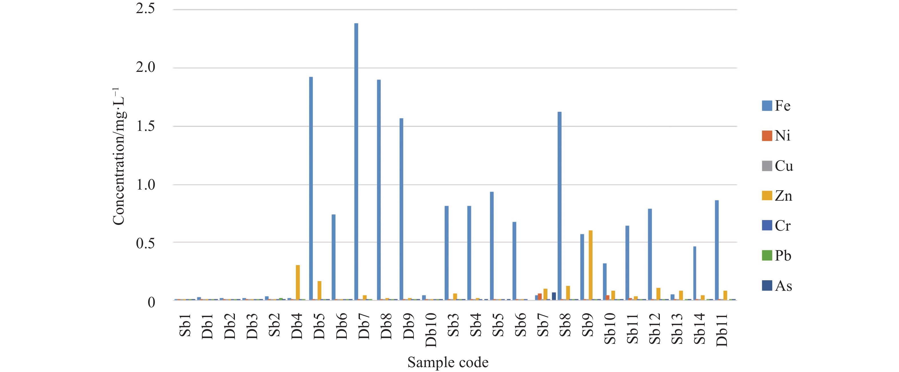
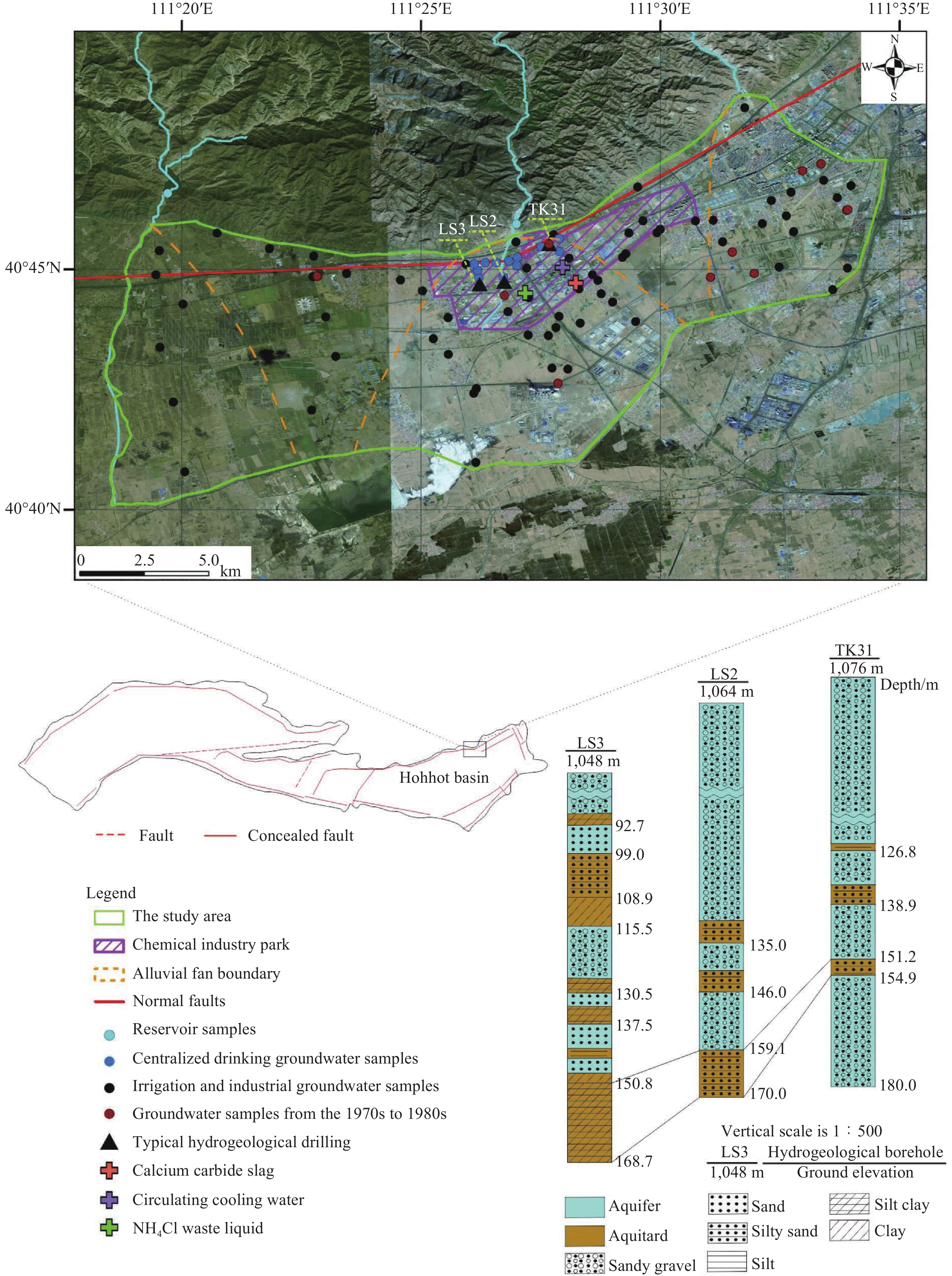
摘要:


2026,
14(2):
188-198. doi: 10.26599/JGSE.2026.9280078
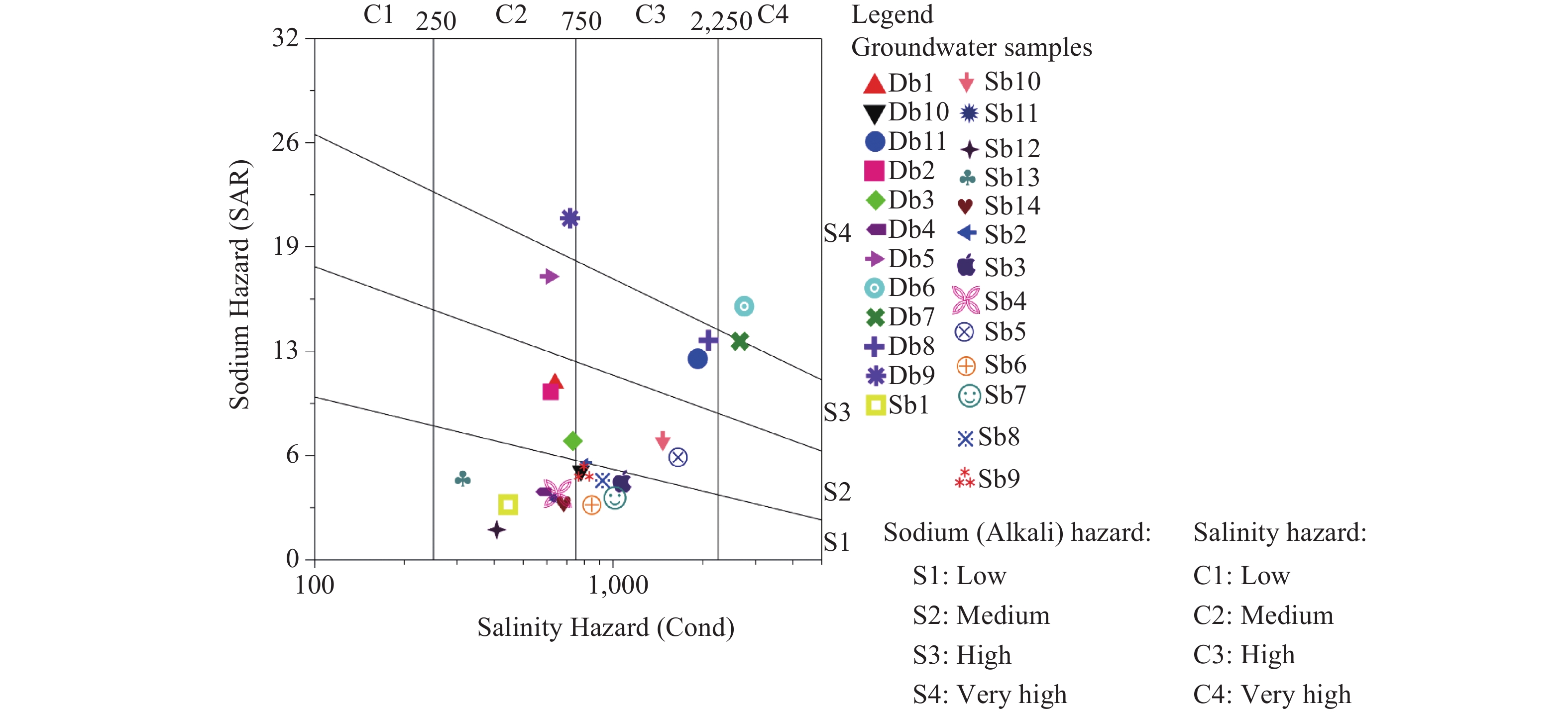
摘要:
2026,
14(2):
199-212. doi: 10.26599/JGSE.2026.9280079
摘要:


2026,
14(2):
213-232. doi: 10.26599/JGSE.2026.9280080
摘要:
2026,
14(2):
233-251. doi: 10.26599/JGSE.2026.9280081
摘要:


2026,
14(2):
252-270. doi: 10.26599/JGSE.2026.9280082
摘要:

 作者投稿
作者投稿 专家审稿
专家审稿 编辑办公
编辑办公 主编办公
主编办公 新闻动态
新闻动态 下载中心
下载中心 友情链接
友情链接


